![[Photo]](https://theparkerfamily.org/wp-content/uploads/2008/03/2310010602_51acf634a8.jpg)
Explore the Photo Set:
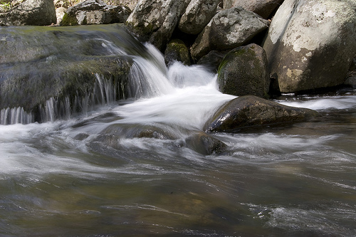
Travel: Discovery Bay National Park, Victoria, Australia
Travel: Discovery Bay National Park, Victoria, Australia
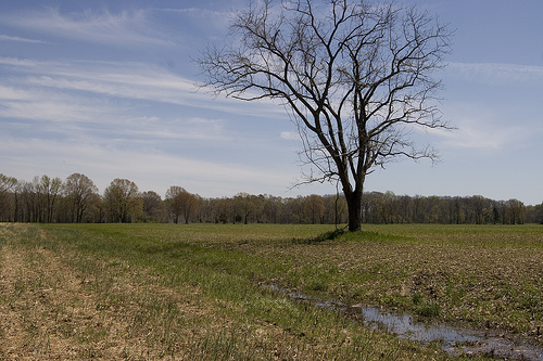
First thing we learned was to not trust state tourism department’s web sites. It makes sense with hindsight, but both Virginia and Maryland seem to have incentive to be less then honest about the status of the foliage in their respective purviews. In their “foliage reports,” they used words like “spectacular” and “peak” that roughly translated to “intermittent” and “you should have visited two weeks ago.”
The only people who seemed to have a clue about what was going on was The Weather Channel, which has a forecast map showing the state of the foliage on the ground. This turned out to be the most correct, largely because it said that vast majority of the country is, in fact, “past peak”.
In search of what was left, we drove out to Elk Neck State Park in Maryland, which is situated right on the northern tip of the Chesapeake Bay. The drive in had some widespread (but muted) foliage, but there wasn’t anything — and I mean anything — once we go into the park itself. From there, we headed 20 miles west of Baltimore to Morgan Run Natural Environment Area. While the drive in wasn’t as pretty as in the far northeast of the state, the hiking was great.
From all reports, this just isn’t going to be a good year for foliage. I found a great write-up on what makes for good foliage, and we just didn’t have the wet growing season and dry, sunny fall needed for anything other than muted, muddy leaf peeping.
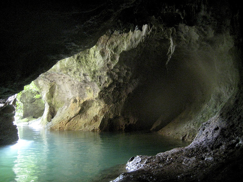
After driving out towards the A.T.M., we parked the van and hiked 45 minutes to the mouth of the caves. Once there, we hopped into the river flowing out of the cave, and swam inside. After about 100 yards, the water was shallow enough to stand up. After hiking through the water for about half a kilometer, we climbed out of the river and spent an hour walking through the formations which 2,000 years earlier were a Mayan burial ground.
The whole day was spectacular, not just the journey, but the formations and especially the Mayan artifacts left untouched for over two millennia.
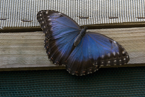
We got up early and spent the morning birding with a local naturalist. After breakfast, we went mountain biking through the nature reserve next door. After lunch, we got a tour of the reserve’s butterfly farm. Finally, after dinner, we hiked the resort’s River Trail (which, up to this point, had been closed due to high water levels caused by the wet season).
I usually use the day to go hiking around the region but this year, with the wedding, I haven’t gotten out as much as I otherwise would have. Today, a friend of mine from TNC and I hiked around Calvert Cliffs State Park for the afternoon, and snapped some pics.
![[ The Washington Monument, Washington Monument State Park, Boonsboro, Maryland ]](https://theparkerfamily.org/wp-content/uploads/2007/03/412203684_3460ee4faf.jpg)
![[Photo]](https://theparkerfamily.org/wp-content/uploads/2007/11/2045000253_6dba485715.jpg)
![[Photo]](https://theparkerfamily.org/wp-content/uploads/2007/11/1856884679_90e15959fa.jpg)
On our way back from the second, we ran into three billy goats (“gruff” presumably) in the middle of the path. Don’t know where they came from — they weren’t anywhere to be seen on the way out — but they were sure enough there on the way back. Initially, things didn’t look particularly good … the biggest one of the bunch approached slowly, dipped its head, and started pawing the ground.
Perhaps, now is a good time to pause for some back-story:
Last year when the lady sparkler and I were in Tucson, we mis-timed one of our hikes and found ourselves out in the desert after dark. As we were scurrying back, we had not one but two rattlesnakes try and kill us. The second of the two actually rattled across the path between the lady sparkler (who stopped) and myself (who sped up).
Yesterday, we were hiking around Mount Richmond in the middle of the day, when I noticed a large tree branch that was down across the path began to move. We’d find out later that it was actually a copperhead, one of the 14 breeds of snakes in Australia that can kill you. Now, when you think copperhead, you think of a normal-sized snake that just happens to be poisonous. This, however, was the size of the basilisk from that Harry Potter movie. It looked like it had recently eaten a moose. Or an auto.
Anyway, back to the goats. The only thing that kept me from running around like a blithering idiot around the snakes — other than the whole “being paralyzed with fear” thing — was that I keep being told that they are just as scared of us as we are of them. The goats? Not afraid of us, though, this turned out to be a good thing.
Momma goat DID dip her head, and pawed the ground, but was just looking to soften up the dirt before she laid down to completely block the path. Her two chil’en quickly followed suit. We gingerly chose about a 6 inch path between the goats and the 200-foot cliff, and resisted the urge to pet the (now) cute little goats. Didn’t want to open ourselves up to *that* conversation with Customs.
Turns out that not everything in Australia is trying to kill you.